

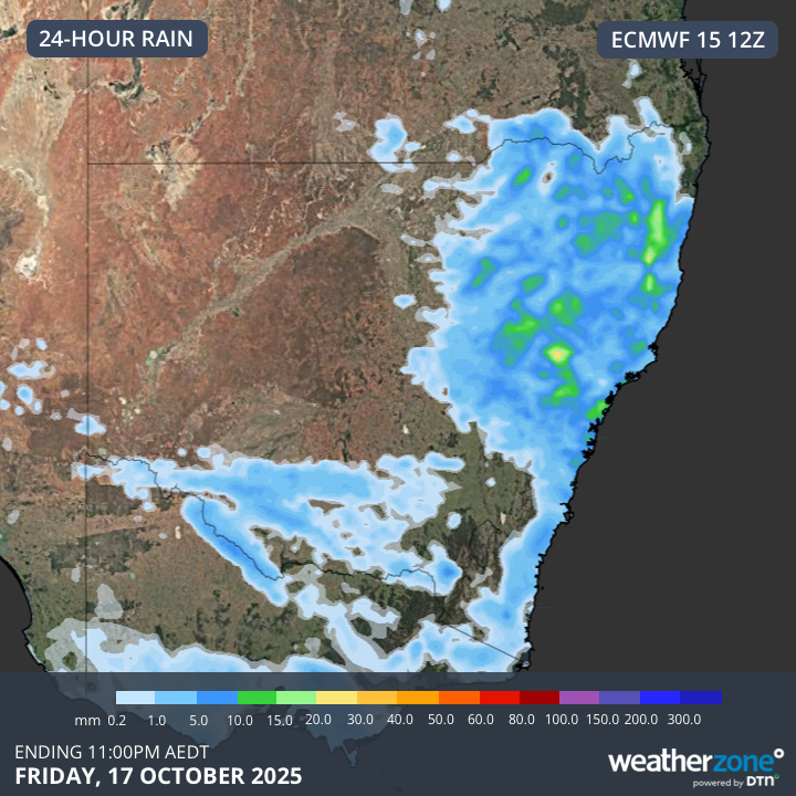
Powerful thunderstorms are expected to sweep across New South Wales today, as high temperatures take hold across the state. The Bureau of Meteorology has warned of severe storms, which could bring strong winds and large hail. Areas most at risk include Sydney, the northern Illawarra, the Hunter, and parts of the Central West.
Credit: WeatherZone
Storms and rain showers are expected to hit Sydney this afternoon, after a hot day with temperatures forecast to reach 32°C. The Bureau of Meteorology said daytime temperatures across northern and central parts of NSW will be well above normal. According to Weatherzone, the stormy conditions are being triggered by a cold front and low-pressure trough clashing with a much warmer air mass over the state.
A high-level trough moving across southeastern Australia on Friday is also expected to make the atmosphere more unstable, leading to thunderstorms in central and northeastern NSW, according to Weatherzone. As of 6am AEDT, the Bureau of Meteorology hadn’t issued any storm warnings, with the main threats expected to be strong winds and hail rather than heavy rain or flooding. However, residents are being advised to stay updated via the Bureau’s website.
Weatherzone has warned that isolated supercell thunderstorms could form on Friday, especially in parts of central eastern NSW. If they do develop, these storms could bring extremely dangerous winds over 125 km/h and hailstones larger than 5 cm.